

Alsek River Rafting Expedition in Alaska & Canada
Rafting the Alsek River: A Remote Wilderness Journey
12-Day Alsek Rafting Expedition
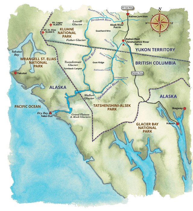
The Alsek River is a Canadian Heritage River and a designated UNESCO World Heritage site that flows through Kluane National Park, Tatshenshini-Alsek Provincial Park, and Glacier Bay National Park.
Haines, Alaska to Serpentine Creek(The Alsek Rafting Put-In)
Our Tatshenshini and Alsek River trips originate in Haines Alaska. The evening before the trip we have a meeting at our warehouse. During this meeting we answer any last questions, get everyone fitted with drysuits, and prepare everyone for the journey to the put in the following morning. Day 1 of the expedition starts with a drive from Haines, Alaska, past the Canadian border into the Yukon Territory of Canada. The trip starts on the Dezadeash River at Serpentine Creek. Getting to Serpentine Creek can be an adventure in itself. The dirt road is extremely rough and crosses many small streams that can become quite large on warm days.
Tatshenshini 11-Day
Alaska Rafting Expedition
Alsek 12-Day
Alaska Rafting Expedition
Grand Canyon Ranch & Raft Map
Grand Canyon Ranch & Raft Map
How Glacial Changes Increased the Flow of the Alsek River
Once at Serpentine Creek, it will be time to eat lunch, load on the rafts, and head downstream. If weather conditions are right, it will be a couple hour float to where the Dezdeash River joins the Kaskawulsh River and forms the Alsek River. In 2016, the Kaskawulsh captured the Slims River due to warming global temperatures and the melting of the Kaskawulsh Glacier. The addition of the Slims River has increased the flow of the Kaskawulsh and Alsek Rivers by a substantial amount. To learn more about this modern geologic event check out our blog post River Piracy without the Skull and Crossbones.

Alsek River Rafting in Kluane National Park
The stretch from the Kaskawulsh–Dezadeash confluence to Lowell Lake is protected grizzly bear habitat, with limited camping to preserve wildlife. The landscape features massive glacial erratics and giant sand dunes—remnants of the ancient Lake Champlagne, formed when the Lowell Glacier once dammed the Alsek River.
A historic axe-hewn oar, found high above the current river near Marble Creek, offers evidence of travel on this long-gone lake.
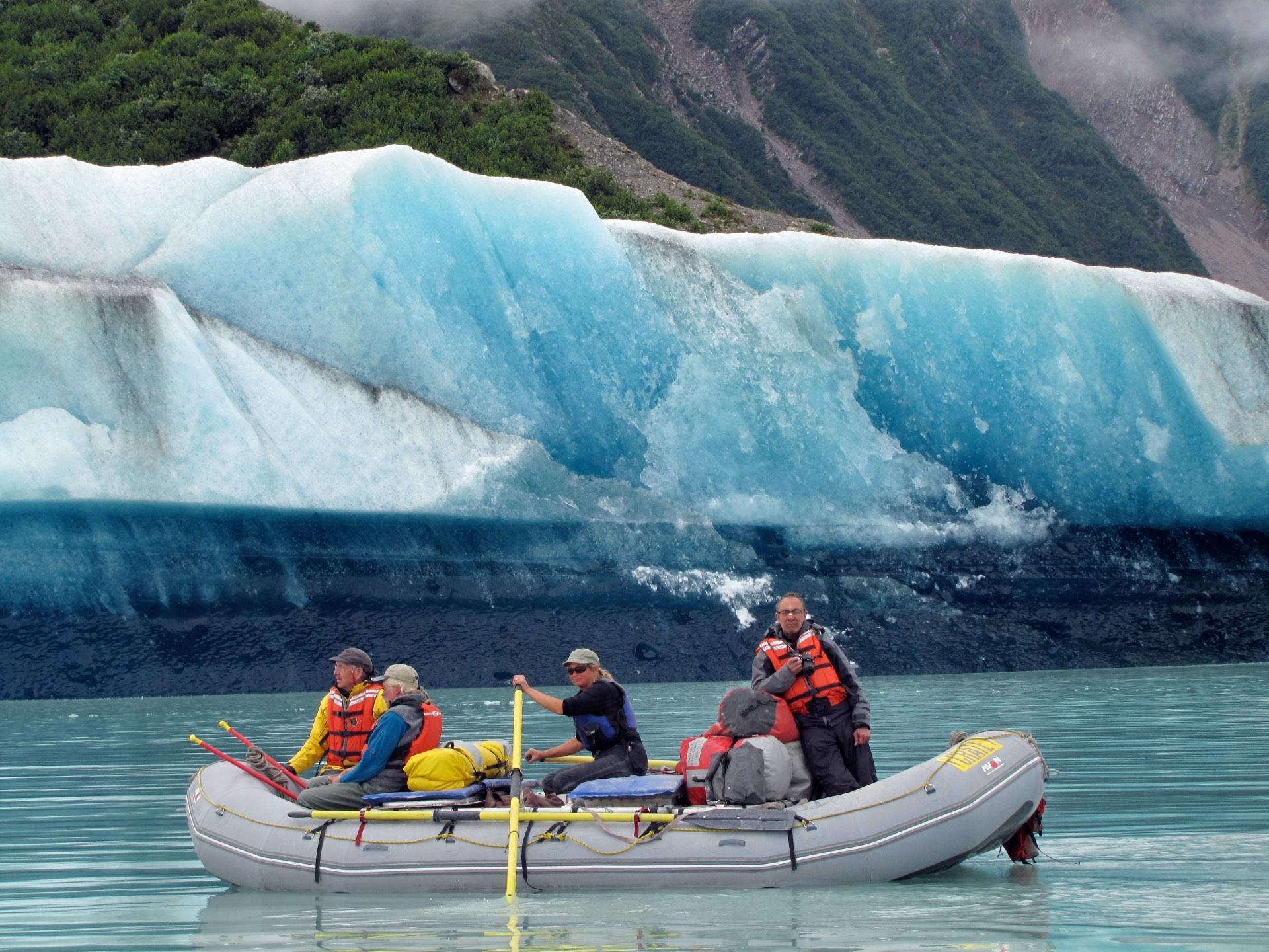
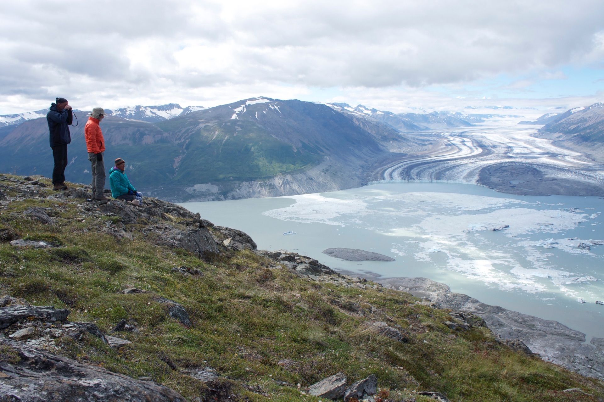
Lowell Glacier provides the first close glacier views of the trip and created Lowell Lake, where trips typically camp. The stark terrain, recently exposed by glacial retreat, preserves wildlife tracks and offers memorable wildlife encounters, including frequent bear sightings.
Why the Alsek River Expedition Is a World-Class Adventure
Lava North Rapid
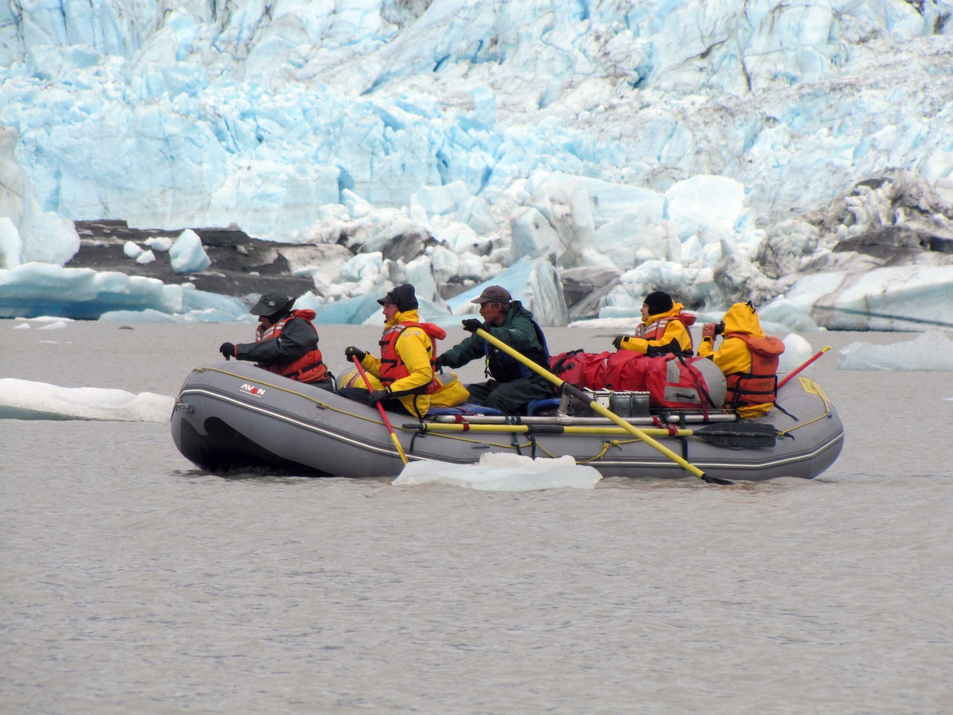
The biggest rapids of the trip are found below Lowell Lake. Everyone will dawn drysuits for this section of river. The first big rapid is easily avoided by taking the right channel around a couple islands. When you look back up river you will be glad to have taken the easy route. The second big rapid is Lava North. Lava North is named after the famous rapid on the Grand Canyon. We will scout the rapid from the left shore. The rapid is full of some big water features just like Lava Falls and Crystal on the Colorado River in the Grand Canyon. The big difference is the water is only 34 degrees Fahrenheit. After successfully navigating Lava North, it is time for some celebration. A tributary from the Fisher Glacier, some turquoise blue water we call Wolverine, and the Bates River follow closely after Lava North.
The Best Fish Tacos Ever and an Energetic Wolverine
On our first trip down the Alsek, we camped on a beautiful sandy beach where a small clear stream of water was flowing past before joining the Alsek. The water was from the melting of the Fisher Glacier. It was one of the most beautiful river camps anywhere. We had some great halibut tacos prepared specially by Martha Clark Stewart and watched the sun set on the colorful mountains downstream. Just as the sun was setting, Mindy Mackay saw a wolverine along the back talus slope of the camp. The wolverine was determined to summit the steep and rocky slope. The wolverine was always moving full speed. There were three different draws on the slope. It attempted the first draw, got about 10 feet from the top, and had to turn around. It ran all the way back to the bottom and up the second draw and back down. Finally the wolverine found a successful route up the third draw, disappearing into the trees and out of sight.
The Spillover Theory: Range Creek on the Alsek River and Detour Creek on the Tatshenshini River
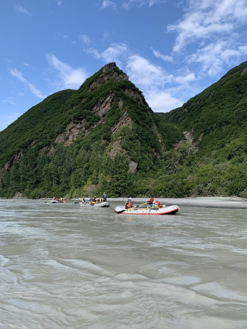
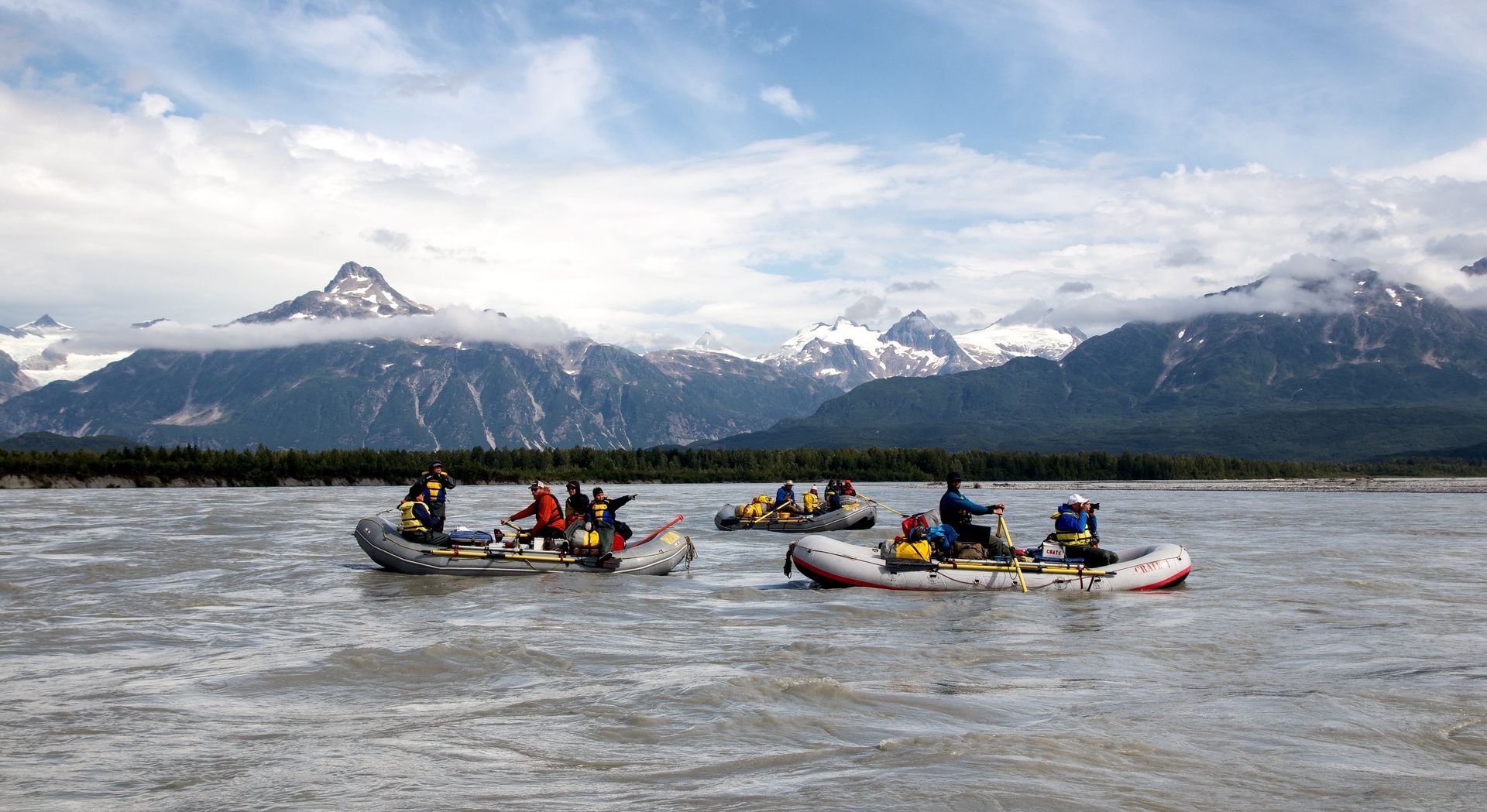
The Alsek River stays fast below Bates Creek. The scenery is breathtaking and the mountains are high. There are amazing waterfalls and sandy beaches. It is not uncommon to see moose or Grizzly Bears unaware of our rafts floating by them. The Alsek River continues to grow in size due to glacial feeder streams. One such stream is Range Creek. As the crow flies, it is about 20 miles from the confluence of the Alsek River and Range Creek to the confluence of the Tatshenshini River and Detour Creek. Range Creek and Detour Creek share the same canyon and have headwaters that are very near each other. The pass into Detour Creek is about 800 feet higher than the Alsek at the Range Creek confluence. It is believed that in the past the Tweedsmuir Glacier has surged just like the Lowell Glacier. As “Lake Tweedsmuir” filled up the Alsek spilled over into Detour Creek and down the Tatshenshini River.
The Story of Bear Knoll on an Alsek River Trip
On one of our Alsek River trips, we camped on a large sandy beach just below Range Creek. It was a warm August day in British Columbia. We camped early and set up camp. After camp was set up, Walker Mackay, John Toner and Sybrena Smith decided to do an exploratory hike up to the top of a knoll behind the camp. From the open beach, the journey would require breaking through some dense foliage before hitting a draw of talus slope up to the top. The guides were almost to the top when they looked down to their left and saw a large Grizzly Bear a little more than a rocks throw away. The bear stood up, sniffed, and ducked back down into the greenery. Instead of running away like almost every bear in Alaska does, the bear moved closer. This time standing up a rocks throw away, the bear was obviously curious. It ducked back down in the greenery and appeared on the other side of the thin ridge at the top of knoll. The bear was within 100 feet. The wind was blowing toward it. After a minute or two of sniffing and standing the bear decided to retreat back into the woods. This encounter was a good reminder to hike in groups in Bear Country. From then on we have called the camp and small knoll behind the camp “Bear Knoll.”
Exploring the Alaskan Serengeti on an Alsek Raft Trip
Leaving from Bear Knoll, the canyon widens and offers nice wildlife viewing opportunities. Sometimes our trip stop at what we call the “Alaskan Serengeti”. The landscape is mostly open with big rolling hills and it is relatively easy to gain elevation, find a nice resting place, and pull out binoculars to scan the landscape.
The Alsek River’s Turnback Canyon, Walt Blackadar, and the Helicopter Portage
Turnback Canyon
The next important stop is at the camp above Turnback Canyon. This is where the helicopter will sling load our boats and carry the people around the class VI whitewater of Turnback Canyon. Across the river the Tweedsmuir Glacier’s blue ice is visible calving off into the Alsek. There is a memorial to Walt Blackadar at this camp.
Blackadar
Blackadar
is famous for his first descent of Turnback Canyon which he completed on August 25, 1971, solo. In doing so, he is revered by an entire generation of paddlers. Blackadar said of the achievement, “One huge horrendous mile of hair, 30 feet wide, 50,000 cubic feet per second and twenty degree downgrade going like hell. Incredible! I did not flip in that mile or I would not be writing….I’ll never go back, not for $50,000, not for all the tea in China.” Blackadar did not start kayaking until he was 43 years old and his run down Turnback Canyon occurred at the age of 49. He was featured in Sports Illustrated where they compared his achievement to the first ascent of Mount Everest. Now Mount Blackadar towers above Turnback Canyon. If time and water levels permit, there may be a chance to hike down to the first rapids of Turnback Canyon, and peer into the same rapids Blackadar paddled into.
The helicopter portage over Turnback Canyon
The helicopter portage over Turnback Canyon is another amazing experience in itself. Viewing the rapids, canyon, and glacier from above has to be experienced to be completely appreciated. Once all of the gear and people are flown around Turnback Canyon, the rafts are re-inflated, rigged, and placed back on the water. Form here to the confluence with the Tatshenshini the river becomes wide and braided.
The Confluence of the Alsek River and Tatshenshini River
At the confluence of the two major river systems the views are awe inspiring. There are petroglyphs on an Island between the two mighty rivers. It is believed at one time the Tlingit village of Tinix Ani was here. The village was believed to have been washed away when a Lowell or Tweedsmuir Glacier Dam broke in the mid 1800s.
The Tatshenshini and Alsek share their last 50 miles. You can visit our Tatshenshini River rafting page to learn about the lower section of these two incredible rivers.
If you have any questions or to book an Alsek River Rafting adventure today please call us at
1-800-253-7328.
