Desolation Canyon: Utah's Hidden Wilderness Gem

People in two red inflatable kayaks on a river, with red rock canyon in background.

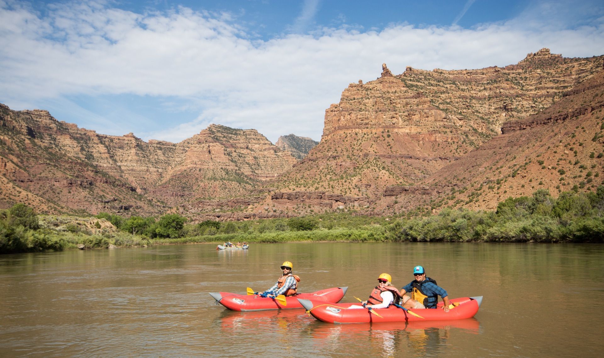
Nestled within the remote canyon country of Utah's Green River Wilderness Area, Desolation Canyon boasts some of the most stunning and unique landscapes in the West. Rafting through this breathtaking region is the ultimate way to experience its natural beauty, rich history, and outdoor wonders.


Desolation Canyon stretches for approximately 84 miles along the Green River, beginning near the town of Green River, Utah, and continuing through some of the most pristine wilderness in the United States. The canyon is characterized by towering red rock walls, deep gorges, and a river that offers the perfect balance of exciting rapids and peaceful floats.

The Green River Wilderness Area

The Green River Wilderness Area encompasses vast stretches of undeveloped land where the river carves through multiple geological layers. The canyon walls reveal millions of years of geological history, with colorful rock formations that shift in hue throughout the day as the sun moves across the sky. The climate is "high desert," hot during the day and cool at night, creating a unique environment for both adventure and relaxation.

Unique Landscapes and Geological Wonders

Desolation Canyon's landscape is truly one-of-a-kind, offering incredible views of natural rock formations, cliffs, and desert landscapes. The rugged beauty of the canyon will surround you as you navigate the river's rapids and peaceful stretches, creating a once-in-a-lifetime experience. The canyon's name, given by early explorer John Wesley Powell, reflects the remote and isolated nature of this wilderness area.

Wildlife and Natural Wonders

As you raft through Desolation Canyon, you may encounter a range of wildlife, including bighorn sheep, desert eagles, river otters, and numerous bird species. There are also ample opportunities for exploration off the river, with short hikes to overlooks and hidden canyons that reveal the canyon's hidden treasures. The pristine wilderness ensures that wildlife viewing is often exceptional, particularly during early morning and evening hours.

More About the Desolation Canyon: Utah's Hidden Wilderness Gem

Sandy beach inside a cavern overlooks a river, with red rock canyon walls and a blue sky.
February 15, 2026
The Colorado River below Glen Canyon Dam flows through the lower reaches of Glen Canyon on its way to Lees Ferry , forming one of the most studied and discussed stretches of river in the American Southwest. Released from the base of the dam, the water is typically clear and tightly controlled. In recent years, however, lower water levels in Lake Powell have caused releases to come from shallower depths, warming the river compared to past decades and changing the conditions downstream. This reach is calm and approachable, making it a popular destination for kayaking, rafting, fishing, and flatwater exploration. Visitors often take time to linger along the banks, explore side canyons, and pull over at small beaches and alcoves—experiencing the river at an unhurried pace that encourages observation and learning.  Quick facts about this stretch of river naturally help frame why it matters:
Glen Canyon Dam with bridge and canyon walls under a blue sky. Water flows towards the dam.
February 12, 2026
The Dirty Devil River joins the Colorado River at River Mile 169.5. John Wesley Powell camped at this confluence on July 28, 1869, describing the tributary as extremely muddy and foul-smelling. Jack Sumner later named it the Dirty Devil. The Dirty Devil is formed by the confluence of Muddy Creek and the Fremont River near present-day Hanksville, Utah. The Fremont River originates at Fish Lake and flows along the Waterpocket Fold through Capitol Reef National Park. Muddy Creek drains the San Rafael Swell. Historic Context — Powell’s Expeditions: Powell’s 1869 expedition recorded the Dirty Devil as both a geographic reference and a warning. In his later expeditions of 1871–72, Powell returned with improved boats and a scientific mandate. Tributaries such as the Dirty Devil became fixed reference points for mapping and geologic observation. Powell’s journals note the heavy silt load and poor water quality here, and his party avoided using the Dirty Devil as a water source when possible.
Camping gear on a sandy beach near a red rock wall and river under a cloudy sky.
February 12, 2026
Camping and Dining