
What We Thought We Knew About Glen Canyon Dam — and What the River Has Taught Us Since
Change Will Continue To Shape Our Future
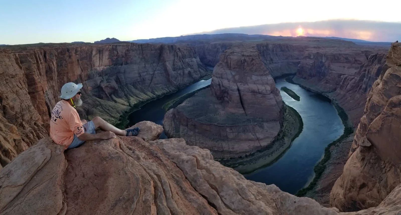
On quiet evenings in the Grand Canyon, when the boats are tied off and the canyon walls catch the last light of day, it’s easy to forget how much of the Colorado River is shaped far upstream. Down here, the river feels ancient and self-directed. The current slides past polished stone. The stars appear one by one. Everything suggests continuity.
And yet, every day on the river is influenced by a massive concrete structure hundreds of miles upstream: Glen Canyon Dam.
For many people, the dam feels permanent—an unquestioned part of the river’s modern identity. It has always been there. It will always be there. It is solid, predictable, and controlled.
But rivers have a long history of challenging certainty.
1962: When the River Was Considered “Solved”
Recently, we revisited a Bureau of Reclamation publication from 1962 titled Questions and Answers: Glen Canyon Dam. It was produced shortly after construction to explain the dam to the American public.
It’s a simple document—plain language, technical clarity, and a calm question-and-answer format. But read today, it feels like a time capsule from an era of extraordinary confidence.
The tone is unmistakable. Every question has a clear answer. Every system is described as manageable. Spillways, diversion tunnels, flood capacity, concrete curing, and power generation are all presented as solved problems.
What’s striking is not what the document gets wrong—much of the engineering is sound—but what it never considers.
There is no discussion of prolonged drought.
No mention of hydrologic uncertainty.
No suggestion that the river might behave outside predicted limits.
To understand how completely the Colorado River was believed to be understood, it helps to let the document speak in its own voice.
What Americans Were Told in 1962
Questions and Answers About Glen Canyon Dam
The following questions and answers are drawn from the U.S. Bureau of Reclamation’s 1962 public-information pamphlet Questions and Answers: Glen Canyon Dam. This is a public-domain government document. The answers below reflect the explanations given at the time, lightly summarized only for clarity—not meaning.
Q: Why was Glen Canyon investigated as a potential damsite?
A: Because of favorable geology, narrow canyon walls, strong bedrock foundations, and suitability for large-scale water storage and hydroelectric power generation.
Q: When was construction begun and completed?
A: Construction began in 1956 and was completed in 1963, with power generation beginning as units were brought online.
Q: How large is the dam?
A: The dam stands over 700 feet high and spans more than 1,500 feet across the canyon.
Q: Why is the dam curved?
A: The arch design transfers water pressure into the canyon walls, increasing strength and efficiency while reducing the amount of concrete required.
Q: How much concrete was used?
A: Approximately five million cubic yards of concrete were used in construction.
Q: Why was concrete placed in blocks instead of one solid mass?
A: Concrete generates heat as it cures. Block placement allowed heat to dissipate and prevented cracking.
Q: How was curing heat controlled?
A: Aggregates were cooled using refrigeration plants, and water was circulated through pipes embedded in the concrete.
Q: Why were diversion tunnels necessary?
A: Four large tunnels routed the Colorado River around the dam site during construction and later served water-control purposes.
Q: How is floodwater handled?
A: Two spillways, one on each side of the canyon, are designed to safely pass excess floodwater around the dam.
Q: How much water can the spillways carry?
A: The combined spillway capacity was designed to safely pass extremely large flood flows.
Q: What prevents water from flowing over the top of the dam?
A: Reservoir operations and spillway releases maintain water levels below the dam crest.
Q: Is Glen Canyon Dam safe?
A: The dam was designed using modern engineering standards with substantial safety margins.
Q: What is Lake Powell?
A: Lake Powell is the reservoir formed behind the dam, providing water storage, power generation, recreation, and downstream regulation.
Q: How large is Lake Powell?
A: When full, it stores over 24 million acre-feet of water and extends nearly 200 miles upstream.
Q: Why is such a large reservoir necessary?
A: It allows water to be stored during wet periods and released during dry periods.
Q: How much power does the dam generate?
A: The powerplant was designed to produce several billion kilowatt-hours of electricity annually.
Q: Why is hydroelectric power important?
A: It provides a renewable, reliable energy source that supports regional growth.
Q: What happens to sediment carried by the river?
A: Sediment settles in the reservoir, while clearer water is released downstream.
Q: How long is the dam expected to last?
A: With proper maintenance and operation, the dam was expected to serve the region indefinitely.
Read together, these answers form a consistent message: the Colorado River could be predicted, controlled, and permanently managed.
History would soon complicate that belief.
1983: When the River Pushed Back
In the spring of 1983, an exceptionally large snowpack built across the Upper Colorado River Basin. A rapid warm-up, combined with spring storms, sent runoff into Lake Powell far faster than forecasts predicted.
Reservoir levels rose quickly. Operators faced a scenario they were determined to avoid: water overtopping the dam.
To prevent that, the spillways were opened.
The Spillway Crisis
As water accelerated through the spillway tunnels, extreme pressure changes caused cavitation—the rapid formation and collapse of vapor bubbles. These collapses acted like explosions.
Concrete and bedrock were torn away from the spillways. Massive cavities formed beneath the flowing water, invisible from the surface. Engineers feared continued erosion could threaten the dam’s integrity.
Emergency measures were taken. Releases were adjusted. Eventually, the crisis passed.
The dam held—but not without damage.
The spillways were later rebuilt and armored, and flood-handling assumptions across the Bureau of Reclamation were reevaluated.
The dam did not fail.
But it behaved in ways no one had publicly anticipated in 1962.
Today’s Question Is the Opposite of 1962’s
In 1962, the dominant concern was abundance.
How do you control too much water?
Today, the concern is scarcity.
Prolonged drought across the Colorado River Basin has pushed Lake Powell to historically low levels. Conversations now center on minimum power pool, hydropower viability, sediment exposure, and what happens if reservoir levels fall below operational thresholds.
These are challenges the dam was never designed to solve.
The system was built around assumptions of:
- Stable long-term hydrology
- Reliable snowpack
- A river that would consistently refill large reservoirs
Those assumptions are now under strain.
Key Lake Powell Elevations (feet above sea level)
1. Full Pool
- Elevation: ~3,700 ft
- Storage: ~24.3 million acre-feet (MAF)
- Meaning:
- Glen Canyon Dam reservoir is full
- Maximum hydropower production
- Normal releases to Lake Mead
2. Minimum Power Pool (“Dead Power”)
- Elevation: 3,490 ft
- Storage: ~7.0 MAF
- Meaning:
- Hydropower turbines can no longer operate
- Glen Canyon Dam cannot generate electricity
- Water can still be released downstream through outlet works
- This is the critical line for:
- Power revenues that fund river operations
- Western power grids that rely on cheap, stable hydropower
Plain language:
The dam still works as a dam, but it’s no longer a power plant.
3. Minimum Release / “Dead Pool”
- Elevation: ~3,370 ft
- Storage: ~2.0–2.5 MAF
- Meaning:
- Water level drops below the lowest outlet works
- No water can pass through Glen Canyon Dam
- The Colorado River effectively stops at the dam
- Catastrophic for:
- Lower Basin water deliveries (AZ, NV, CA)
- Mexico treaty deliveries
- Grand Canyon river flows
Plain language:
The dam becomes a concrete plug in the river.
Why These Thresholds Matter
Dead Power (3,490 ft)
- Loss of ~5 billion kWh/year of clean energy
- Power revenues fund:
- Dam operations
- Salinity control
- Environmental programs
- Grid operators must replace it with fossil fuels
Dead Pool (3,370 ft)
- No releases to:
- Grand Canyon
- Lake Mead
- Hoover Dam
- Breaks the Law of the River
- Forces emergency federal intervention
- Would fundamentally change how the Colorado River is managed
Real-World Context (Recent History)
- Lowest recorded elevation: ~3,522 ft (2022)
- That was:
- ~32 ft above dead power
- ~150 ft above dead pool
- Emergency releases from Flaming Gorge, Blue Mesa, and Navajo Reservoir were used specifically to protect power pool
A River Guide’s Perspective
At Colorado River & Trail Expeditions, we don’t approach the dam as engineers or policymakers. We approach it as people who live with its downstream effects every season.
We see how regulated flows shape campsites.
We watch daily releases influence rapids and eddy lines.
We hear guests ask thoughtful questions late at night, under the stars.
Could the dam stop working someday?
What happens if Lake Powell can’t generate power?
What would the canyon be like without it?
We don’t offer simple answers—because rivers don’t offer simple answers.
What we can offer is perspective.
What the River Has Taught Us
The arc from 1962 to today tells a clear story.
The river was never fully solved.
It was temporarily constrained.
And it continues to remind us of its scale.
Rivers demand humility.
They change.
They surprise.
They outlast assumptions.
On a Grand Canyon river trip, this lesson reveals itself quietly—in shifting sandbars, changing weather, and long nights beneath a sky far older than any dam.
Looking Forward Without Pretending to Know
The 1962 Questions and Answers pamphlet shows us what certainty looked like.
1983 shows us what happens when reality exceeds expectations.
Today reminds us that the river is still writing the story.
At CRATE, we don’t pretend to know how this chapter ends. What we do know is that the Colorado River has always outlasted our confidence in controlling it.
Out here, surrounded by stone shaped over millions of years, certainty feels less important than respect.
We will continue to adapt to what the river gives us.
Halfway through Summer 2026 we have learned a lot about lower flow patterns and the skills and changes needed to navigate the lower water.
Source Acknowledgment
Historical quotations and technical descriptions are drawn from the U.S. Bureau of Reclamation publication Questions and Answers: Glen Canyon Dam (1962), a public-domain government document.
More About the What We Thought We Knew About Glen Canyon Dam — and What the River Has Taught Us Since