We left our Ross Wheeler River Camp with our two motorized rafts at 7:45 AM. We ran Bass Rapid and then stopped at beach on river right to do a hike up to William Wallace Bass’ tourist camp from the 1890’s. The hike was about 4 miles round trip and consisted of gaining about 600 feet of elevation to a saddle, then dropping about 400 feet into Shinumo Creek. We hiked along Shinumo Creek another half-mile to the Bass Camp. There were a lot of big cottonwood trees along the river, and the canyon was very beautiful. There were old coffee pots, an old stove, and lots of other camp artifacts. The trail was well-traveled, but full of rocks and boulders to maneuver around.
Because we got an early start on the hike, most of the trail was in the shade on the way up. On the way back, we were mostly in the sun. Most of the group went on the hike, but some stayed at the boats to enjoy quiet time by the river. By the time we all got back from the hike, it was almost lunch time. The guides set up a deli-style lunch in the shade of some Tamarisk trees. The lunch included a plentiful variety of fresh vegetables, deli meats, bread, lots of pickles and peppers and other fixings, and assorted cookies, Pringles, and apples and oranges.
After lunch, we got back on the rafts and traveled about a half-mile downriver to where Shinumo Creek joins the Colorado River. We hiked about 300 yards up the creek to a small waterfall and pool. The water was cool and felt good after being in the hot noon-day sun. We hung out at the pool for about 30 minutes before heading back to the rafts.
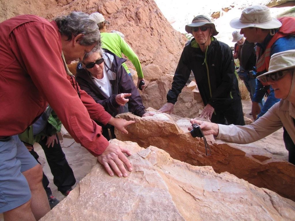
The afternoon was HOT! And the splash from the rapids of Shinumo, Hakati, Walthenburg, and an assortment of smaller riffles was welcome. We pulled into Elves Chasm just as the upper parts of the Canyon were getting a little shaded. The hike up Elves was short but consisted of hiking over a lot of different boulders before seeing an incredible waterfall and pool. Anyone who wanted to, swam in the pool and climbed up behind the waterfall. By the time everyone got back to the boats, parts of the river were in the shade.
We traveled another 45 minutes on the river and then camped on a big sandy beach on the right side of the river. This was our fourth night on the river and our group had become good friends. Everyone helped as we formed a fire line up the beach and passed the gear off the rafts: first the personal dry bags, next the sleep kits, then cots and chairs, and lastly the kitchen set-up and cooking supplies. After all the gear was unloaded, we all found our own personal camping spaces, set up our cots, and made a home for the night.