Canyonlands National Park: A Complete Guide to Utah's Wilderness
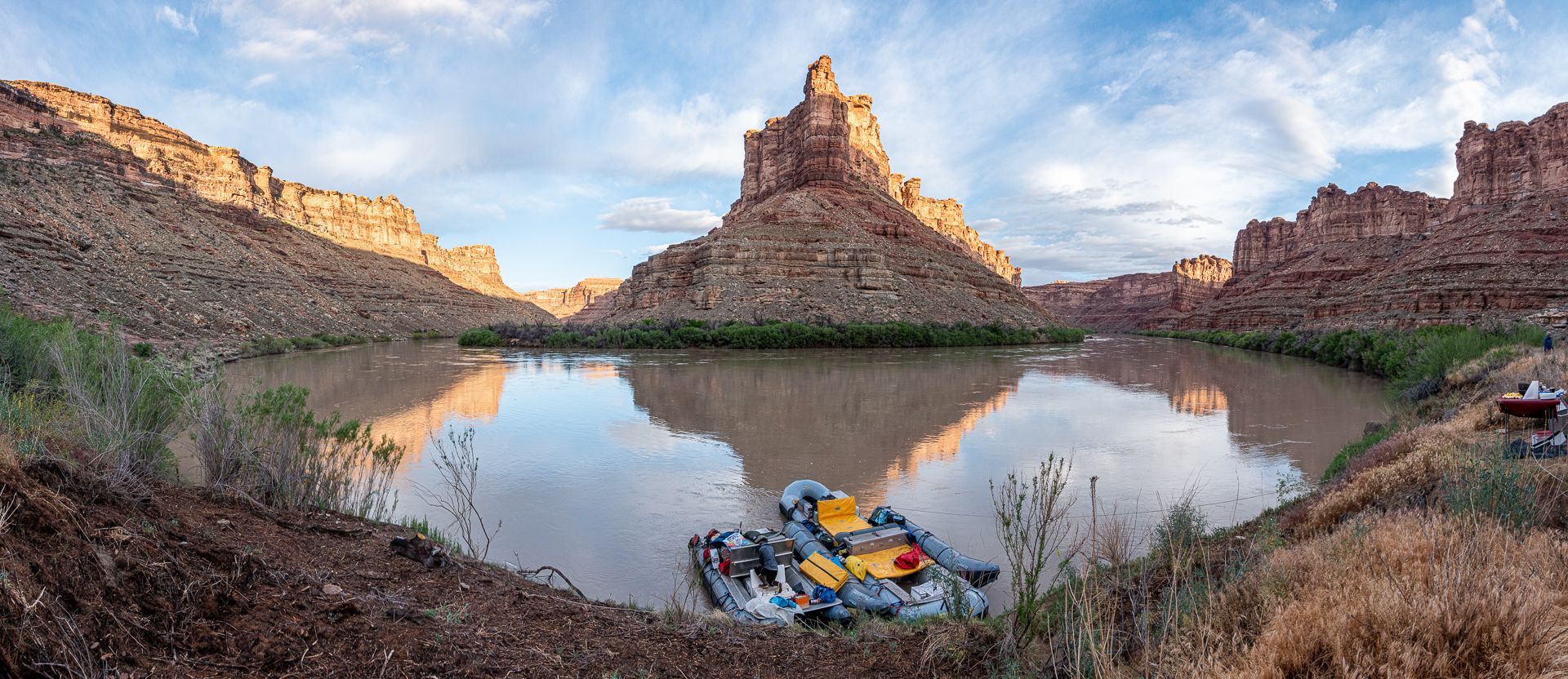
Canyonlands National Park covers a vast, undeveloped wilderness area in Southeastern Utah consisting of unique and colorful landscapes that inspire the imagination and encourage exploration. The Green and Colorado Rivers and their tributaries have cut through sedimentary rock formations to carve immense terraced canyons. The colors of the rocks cover almost every spectrum of an artist's palette, depending upon the time of day and the angle of the sunlight. The climate is "high desert," hot during the day and cool at night.
A rafting trip is the ultimate way to see and experience the wild heart of Canyonlands National Park, which is located in southeastern Utah, in the heart of the Colorado Plateau. The park spans over 337,000 acres of desert landscape, known for its dramatic canyons, towering mesas, and rock formations sculpted by millions of years of wind and water erosion.
The Four Districts of Canyonlands National Park
Island in the Sky:The land that divides the Colorado River and Green River before their confluence, offers panoramic views of the park's canyons and mesas. This district is accessible by vehicle and offers stunning overlooks and hiking trails.
The Needles:Encompasses the Eastern Side of Canyonlands National Park. Known for its colorful spires and rock formations, The Needles offers a more remote experience with excellent hiking and camping opportunities.
The Maze:A remote and rugged area on the West side of Canyonlands National Park, ideal for adventurers looking for solitude and exploration. Many of its beautiful locations can be accessed by river, making it a unique destination for rafting expeditions.
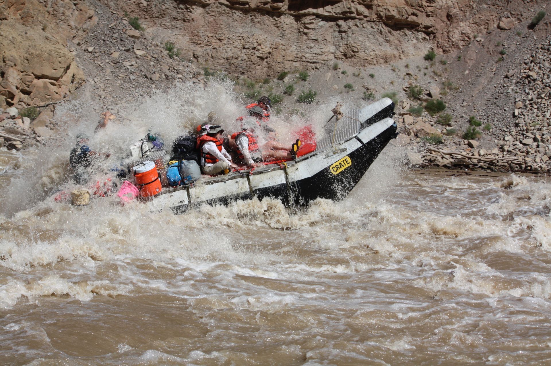
The Rivers:Where the Colorado River and Green River converge, including the famous Cataract Canyon. This is the most accessible district and offers the best whitewater rafting experiences in the park.
Scenic Beauty and Natural Wonders
The canyons and mesas surrounding Cataract Canyon are truly one-of-a-kind, offering incredible views of natural rock formations, cliffs, and desert landscapes. The rugged beauty of Canyonlands will surround you as you navigate the river's rapids, creating a once-in-a-lifetime experience.
Wildlife and Exploration
As you raft through Cataract Canyon, you may encounter a range of wildlife, including bighorn sheep, desert eagles, and river otters. There are also ample opportunities for exploration off the river, with short hikes to overlooks and hidden canyons that reveal the park's hidden treasures.