Utah Rafting Predicted to Be Epic

Water Supply Looking Good For Utah Rivers

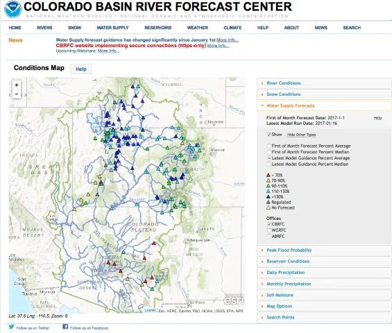
The Colorado River Basin Forecast Center report released on January 16, 2017 predicts an incredible summer of rafting on Utah’s Green and Colorado Rivers. The latest model predicts the water supply at Green River, Utah will be greater than 130% of normal, and the Colorado River at Cisco, Utah will be 110-130% of normal. These high numbers are a result of a series of storms that blanketed Utah, Wyoming, and Colorado with snow.

What This Means For Utah Rafting

If you have been waiting to experience high flows and huge rapids then come see them in Cataract Canyon. Colorado River & Trail Expeditions has 3 and 4 day motorized launches scheduled throughout May and June, and 6-day oar powered trips in July and August when the water drops out. We can also do custom dates and trip lengths for groups of 12 or more. Historically the peak flow should happen sometime between Memorial Day and the middle of June. At flows above 40,000 cfs the Colorado River in Cataract Canyon has rapids bigger than the Grand Canyon. When the river drops out the rapids are still fun and exciting.


2017 should also be a great year for river rafting on the Green River through Desolation Canyon. Desolation Canyon’s rapids are smaller than Cataract Canyon, but they are greater in numbers and give participants the chance to be the captain of their own ship in inflatable kayaks. Desolation Canyon is a great choice for multi-generational groups and families because it is more suitable for younger kids and offers something for everyone. CRATE starts our Desolation Canyon season in mid May and trips are scheduled into August.

I want to go! Now What?

To check availability or make a reservation please call us at 1-800-253-7328 or send an e-mail to crate@crateinc.com. We will be happy to answer any questions you might have and prepare you for your Utah rafting adventure.

More About the Utah Rafting Predicted to Be Epic

Sandy beach inside a cavern overlooks a river, with red rock canyon walls and a blue sky.
February 15, 2026
The Colorado River below Glen Canyon Dam flows through the lower reaches of Glen Canyon on its way to Lees Ferry , forming one of the most studied and discussed stretches of river in the American Southwest. Released from the base of the dam, the water is typically clear and tightly controlled. In recent years, however, lower water levels in Lake Powell have caused releases to come from shallower depths, warming the river compared to past decades and changing the conditions downstream. This reach is calm and approachable, making it a popular destination for kayaking, rafting, fishing, and flatwater exploration. Visitors often take time to linger along the banks, explore side canyons, and pull over at small beaches and alcoves—experiencing the river at an unhurried pace that encourages observation and learning.  Quick facts about this stretch of river naturally help frame why it matters:
Glen Canyon Dam with bridge and canyon walls under a blue sky. Water flows towards the dam.
February 12, 2026
The Dirty Devil River joins the Colorado River at River Mile 169.5. John Wesley Powell camped at this confluence on July 28, 1869, describing the tributary as extremely muddy and foul-smelling. Jack Sumner later named it the Dirty Devil. The Dirty Devil is formed by the confluence of Muddy Creek and the Fremont River near present-day Hanksville, Utah. The Fremont River originates at Fish Lake and flows along the Waterpocket Fold through Capitol Reef National Park. Muddy Creek drains the San Rafael Swell. Historic Context — Powell’s Expeditions: Powell’s 1869 expedition recorded the Dirty Devil as both a geographic reference and a warning. In his later expeditions of 1871–72, Powell returned with improved boats and a scientific mandate. Tributaries such as the Dirty Devil became fixed reference points for mapping and geologic observation. Powell’s journals note the heavy silt load and poor water quality here, and his party avoided using the Dirty Devil as a water source when possible.
Camping gear on a sandy beach near a red rock wall and river under a cloudy sky.
February 12, 2026
Camping and Dining