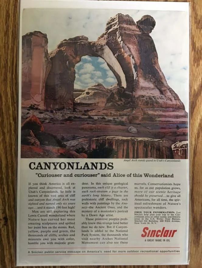
“A Sinclair Public Service Message on America’s Need for more Outdoor Recreation Opportunities”
While thumbing through an old magazine from the early 1960s I came upon this ad put out by Sinclair Oil Company.
“for as our population grows, more of our scenic heritage should be preserved…to give all Americans, for all time, the spiritual refreshment of Nature’s Spectacular wonders.”
With all that is happening today it was refreshing to see an ad put out in support of protecting our natural resources by an oil company. The ad from 50 years ago seems so relevant. It would be great to see something like this today for Bears Ears, Greater Canyonlands, or Greater Grand Canyon.