October 22, 2026

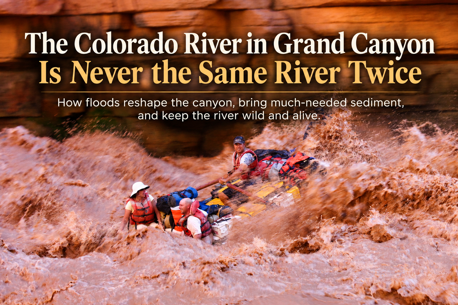
The Colorado River in Grand Canyon Is Never the Same River Twice

By Walker Mackay - Colorado River & Trail Expeditions

The floods that shape and improve the Colorado River in Grand Canyon

October 22, 2026


Heavy rain is falling across northeastern Arizona, northwestern New Mexico, southern Utah, and southwestern Colorado. Rivers and streams throughout the region are responding with dramatic increases in flow.


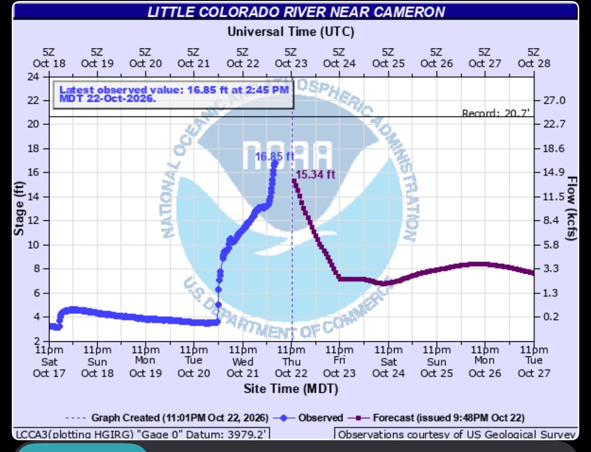
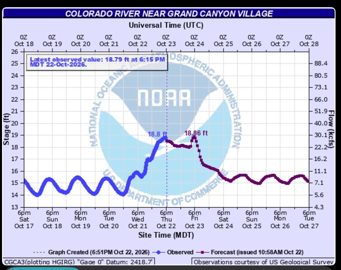
The Little Colorado River, which often flows at around 220 cubic feet per second (cfs) where it joins the Colorado River, has surged to nearly 18,000 cfs. Meanwhile, the Colorado River gauge near Phantom Ranch, deep in Grand Canyon, has risen from approximately 5,000 cfs to nearly 30,000 cfs.


The Grand Canyon may be millions of years old, but the river running through it can change overnight.


I've spent more than 40 years exploring the Colorado River and Grand Canyon, and one thing I've learned is that floods don't just bring high water. They move sediment, build beaches, reshape rapids, and sometimes dramatically change the river channel.


While floods can create challenges and hazards, they also play an essential role in the natural processes that shape Grand Canyon.


And this October flood could bring some important benefits to a river system that has been dramatically altered by Glen Canyon Dam.


Little Colorado River gauge at Cameron
Colorado River at Phantom Ranch gauge during October 22 flood 2026

Why Grand Canyon Needs Sediment


Before Glen Canyon Dam was completed in 1963, the Colorado River transported enormous quantities of sediment through Grand Canyon. Historical estimates put the annual sediment load at roughly 100 million tons, although the amount varied considerably from year to year.


Today, according to the U.S. Geological Survey (USGS), the Colorado River downstream of Glen Canyon Dam transports only about 5–20% of its historical sand load. In other words, the amount of sand moving downstream has been reduced by approximately 80–95%.


Much of the sediment that once traveled through Grand Canyon is now trapped in Lake Powell behind Glen Canyon Dam, gradually accumulating in the reservoir.


The Paria River and Little Colorado River have become two of the most important remaining sources of sand entering the Colorado River below the dam.


When these tributaries flood, they deliver enormous quantities of sand, silt, and clay into the main river channel. Not all of this material contributes equally to building beaches. Sand is especially important because it can accumulate along the river's margins and form the sandbars that are such an important part of Grand Canyon.

These beaches serve several purposes:


  • River camping: Sandbars provide campsites for thousands of Grand Canyon rafters and hikers each year.
  • Wildlife and ecosystems: Sandbars and shorelines provide important aquatic and riparian habitats.
  • Archaeological preservation: Sand deposited along the river can be carried by wind to nearby archaeological sites, helping protect them from erosion.
  • The natural river system: Sediment movement is one of the fundamental processes that continues to shape Grand Canyon.


Without an adequate supply of sand, many of the canyon's beaches gradually erode away.


Source: USGS — High-Flow Experiments on the Colorado River


Man-Made Floods And High Flow Experiments(HFE) In Grand Canyon


One way scientists and river managers have attempted to rebuild Grand Canyon's beaches is through controlled high-flow releases from Glen Canyon Dam.


These releases, known as High-Flow Experiments (HFEs), began in 1996 and have been conducted periodically since then.


The concept is relatively simple.


When tributaries such as the Paria River and Little Colorado River deliver large amounts of sediment into the Colorado River, some of that sand accumulates on the riverbed.


By temporarily increasing releases from Glen Canyon Dam, scientists can use the additional water to mobilize that sand and deposit some of it onto beaches and sandbars along the river.


These experimental releases have typically peaked between approximately 31,500 and 45,000 cfs and have lasted anywhere from about 36 hours to several days.


The experiments have successfully rebuilt beaches in portions of Grand Canyon, although their effectiveness depends on the amount and characteristics of the available sand, as well as the timing, magnitude, and duration of the high flows.


Before Glen Canyon Dam, however, the Colorado River was a very different river. Natural spring floods regularly reached flows far greater than those seen today.


How Big Did The Colorado River Get Before Glen Canyon Dam?


Some of the largest known historical floods on the Colorado River were truly extraordinary.


Historic Colorado River Floods at Lees Ferry

Year Peak Flow at Lees Ferry Significance
1884 210,000 cfs Largest known historical flood, reconstructed from historical evidence.
1921 170,000 cfs One of the largest floods in the USGS streamflow record.
1957 125,000 cfs Major flood before Glen Canyon Dam.
1983 97,000 cfs Major high-water event after Glen Canyon Dam was completed.

The 1884 and 1921 peaks are USGS estimates with uncertainty, while the later figures come from the historical streamflow record.


To put those numbers into perspective, the Colorado River's current flow of nearly 30,000 cfs near Phantom Ranch is impressive, but the largest known historical flood at Lees Ferry was estimated at roughly seven times that amount.


It's also important to recognize that the October 2026 flow near Phantom Ranch includes water entering from tributaries below Glen Canyon Dam. It is not equivalent to releasing 30,000 cfs directly from the dam.


These enormous historical floods were once part of the river's natural cycle. They moved sediment, reshaped rapids, built beaches, and continually changed the landscape of Grand Canyon.

Source: USGS — Historical Colorado River Floods at Lees Ferry


The Challenges of a Muddy Colorado River


Sediment from Colorado River below Little Colorado River during a flood event.

I've been to the Little Colorado River many times when it was flooding and carrying tremendous amounts of sediment. It is remarkable to watch the muddy water enter the Colorado River and turn what was clear, dam-released water into a muddy river almost instantly.


For river runners, that muddy water creates some challenges. Dishwater needs time to settle, filtering river water for drinking becomes much more difficult, and anyone with long hair can tell you how much harder it is to wash your hair in a muddy river.


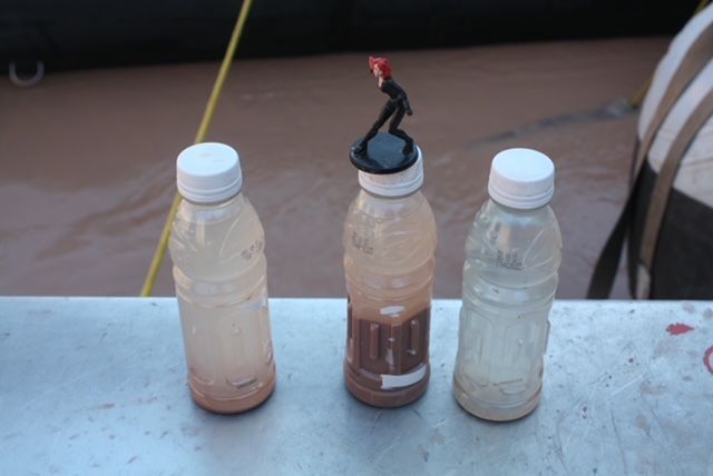
I've even collected muddy Colorado River water in a bottle and watched the sediment settle out. Sometimes it seems like there is almost as much mud as water.


But those inconveniences are a small price to pay for the benefits sediment can bring to Grand Canyon.

And this October flood may do more than deliver much-needed sand. High flows can also help reshape the river channel itself.


High Flows Can Help Clear Debris From Grand Canyon Rapids


The Colorado River in Grand Canyon no longer experiences the enormous seasonal floods that once helped maintain and reshape its rapids.


When flash floods rush down side canyons, they carry rocks, boulders, sand, and debris into the main Colorado River. These deposits can build up at the mouths of tributaries, constrict the river channel, and make rapids larger or more technical.


Before Glen Canyon Dam, this process happened regularly. But each spring, the Colorado River's powerful snowmelt floods could scour away or redistribute some of the material deposited by side canyon floods during the previous year.


Today, without those large seasonal floods, some debris deposits can remain in place for longer periods.


One example is Bedrock Rapid, which, in my experience, has become increasingly constricted over the past five years. The passage has become tighter and more technical to navigate.


In theory, a sufficiently large flow could help move some of the accumulated material and potentially widen the channel. Whether this particular flood can accomplish that is another question.


Another interesting example is the recent flash flood down Bright Angel Creek in August 2026. That flood deposited so much material into the Colorado River that it transformed what had been a relatively minor riffle into a substantial rapid almost overnight.


It will be fascinating to see what this October high water does to these locations.


Will it scour away some of the debris at Bright Angel Creek? Could it widen the channel at Bedrock Rapid? Or will the deposits remain largely unchanged?


The answer depends on the hydraulic forces at each location, the size and arrangement of the deposited material, and how long the higher flows persist. Sand and smaller gravel can move relatively easily, while large boulders may require much greater forces.


A flow of 30,000 cfs could produce noticeable changes in some places and very little change in others.


We won't know exactly what has changed until the river returns to lower flows and river runners have a chance to see the results.


Beach Building: A Natural Benefit of Flooding


One of the most exciting potential benefits of this October flood is the opportunity to rebuild beaches and campsites throughout Grand Canyon.


I would expect the large influx of sediment from the Little Colorado River to create opportunities for beach building downstream of its confluence with the Colorado River near river mile 62.


However, whether individual beaches grow or shrink will depend on how much sand is delivered, how the river transports it, and where it is deposited.


One interesting difference between natural tributary floods and high-flow experiments from Glen Canyon Dam is the relationship between water and sediment.


High-flow experiments release relatively clear water from Lake Powell and rely on sediment previously delivered by tributaries. Natural tributary floods can bring a large pulse of water and fresh sediment into the river at the same time.


The shape of the flood hydrograph—how quickly the river rises, how long it stays high, and how it recedes—can also influence where sand is deposited.


Natural floods don't always recede gradually. Some flash floods rise and fall very quickly, while others produce more sustained high water. Likewise, dam releases can be managed with different recession rates.


What matters for beach building is the combination of available sand and the hydraulic conditions that allow it to be deposited along the river's margins.


Over the years, I've witnessed firsthand how dramatically high flows can change Grand Canyon's beaches.


Following high-flow experiments from Glen Canyon Dam, I've seen enormous beaches rebuilt below Tapeats Creek, Olo, and Bass. Areas that had previously lost much of their sand were transformed into beautiful campsites again.


I've also witnessed what happens to some of that sediment farther downstream.


Below Separation Canyon, where the Colorado River approaches Lake Mead, sediment carried through Grand Canyon can settle out and create extensive sandbars. These deposits can make navigating the river difficult, particularly before the muddy Colorado River water transitions into the clearer water of Lake Mead.


It's a reminder that sediment is constantly moving through the river system, building beaches in some places while creating new obstacles in others.


And not every beach will necessarily benefit from this flood. High water can erode sandbars in some locations while depositing sand in others.


Another benefit I've observed from both natural floods and controlled high flows is the way rising water can wash over frequently used campsites, removing footprints and some accumulated surface debris and leaving behind freshly deposited sand and a clean campsite.


Of course, high water can also leave behind driftwood and other debris. But the ability of the river to continually reshape and renew its beaches is one of the things that makes Grand Canyon so remarkable.


Looking Forward to Seeing the Changes in 2027


I'm sure I'll hear reports over the coming weeks and months about how this October flood has changed Grand Canyon's beaches, channels, and rapids.


But what I'm really looking forward to is returning to the Colorado River next April and seeing those changes with my own eyes.


Will there be new beaches? Will some of the rapids have changed? Will the river have cleared out some of the debris left behind by recent flash floods?


I hope we find some positive changes, with the river's natural processes doing what they have done for millions of years.


And let's hope the rain and snow keep coming this winter, setting us up for an amazing year on the river in 2027.


I've been fortunate to have a close connection with the Colorado River and Grand Canyon for more than 40 years. One of the things that continues to amaze me is how much the river changes, even after all the time I've spent on it.


The Colorado River in Grand Canyon is never the same river twice. Every flood, every tributary flash flood, and every movement of sand and rock reshapes the Colorado River and the Grand Canyon.


Experience Grand Canyon for Yourself in 2027

There is no better way to appreciate Grand Canyon's constantly changing geology than to experience the Colorado River firsthand.


Join Colorado River & Trail Expeditions on a Grand Canyon rafting trip in 2027 and see this extraordinary landscape from the river.


Explore our trips at www.crateinc.com or call 1-800-253-7328 to learn more and reserve your place.


About the Author


Walker Mackay has guided rafting expeditions on the Colorado River through Grand Canyon for more than 30 years and has been exploring the canyon for over four decades. As a second-generation river outfitter with Colorado River & Trail Expeditions, he has spent much of his life sharing Grand Canyon with others. After all these years, it remains his favorite place on Earth, and he is already looking forward to his next trip down the river.


Grand Canyon Rafting Information 2027
By Walker Mackay • October 13, 2026
A river guides perspective of the questions and challenges Grand Canyon Rafting faced in 2026 and why you should raft the Grand Canyon in 2027.
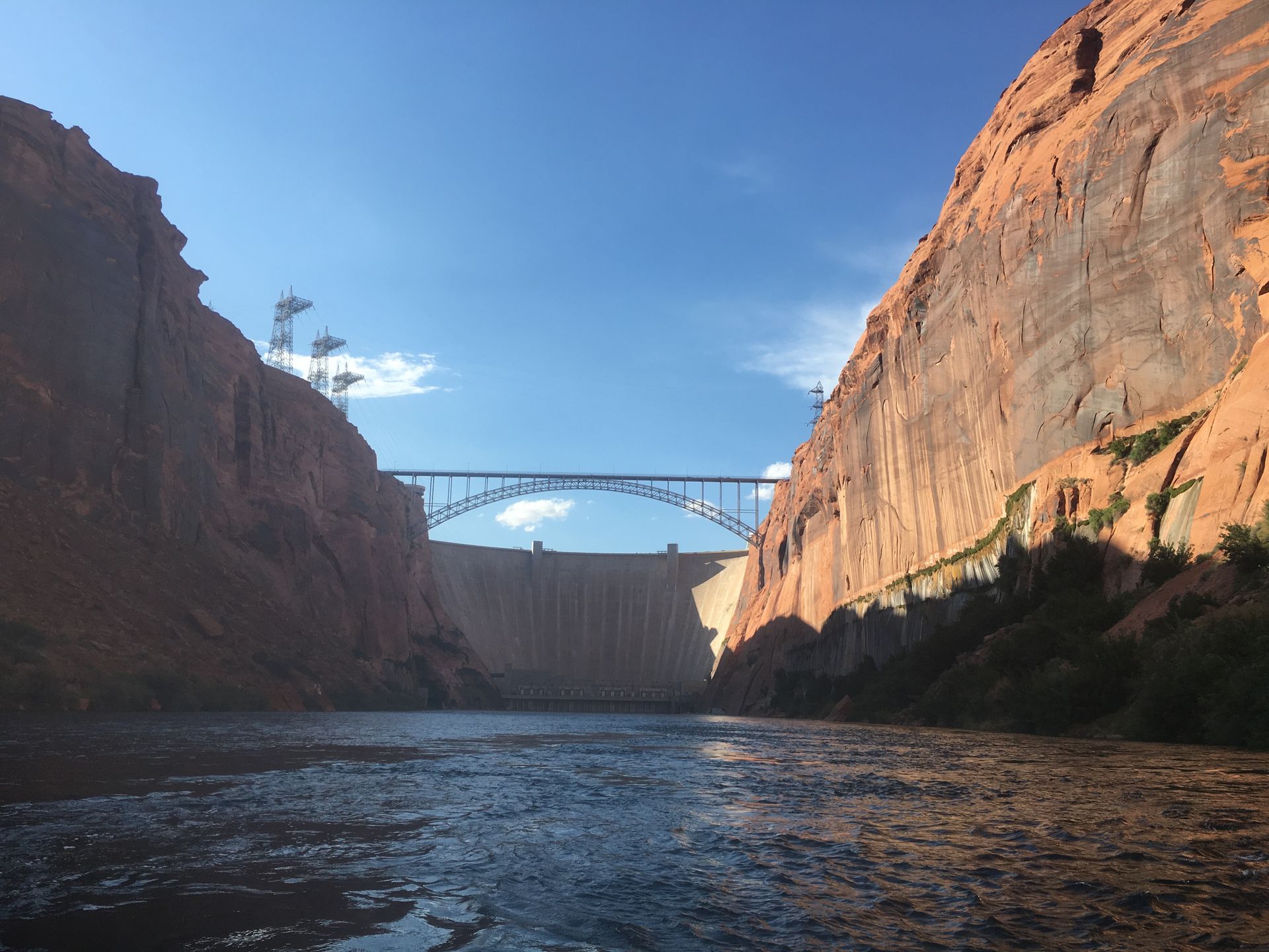
Glen Canyon Dam
By Colorado River & Trail Expeditions • July 7, 2026
A view of Glen Canyon Dam.
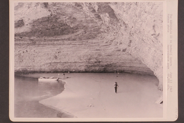
Ed Hudson Photo of Redwall
By Walker Mackay • June 1, 2026
The First Motorized boat trip through the Grand Canyon.
Time to make coffee on the Colorado River.
By Walker Mackay • May 6, 2026
A professional grand canyon rafting guides account of making coffee in the morning on a rafting trip.
Hiking up Matkatamibia.
By Walker Mackay • April 24, 2026
Answer the question how physically demanding is a Grand Canyon river trip.
view from Nankoweep
By Walker Mackay • April 14, 2026
Colorado River & Trail Expeditions has photo sharing on our website. You can upload photos from your trip.
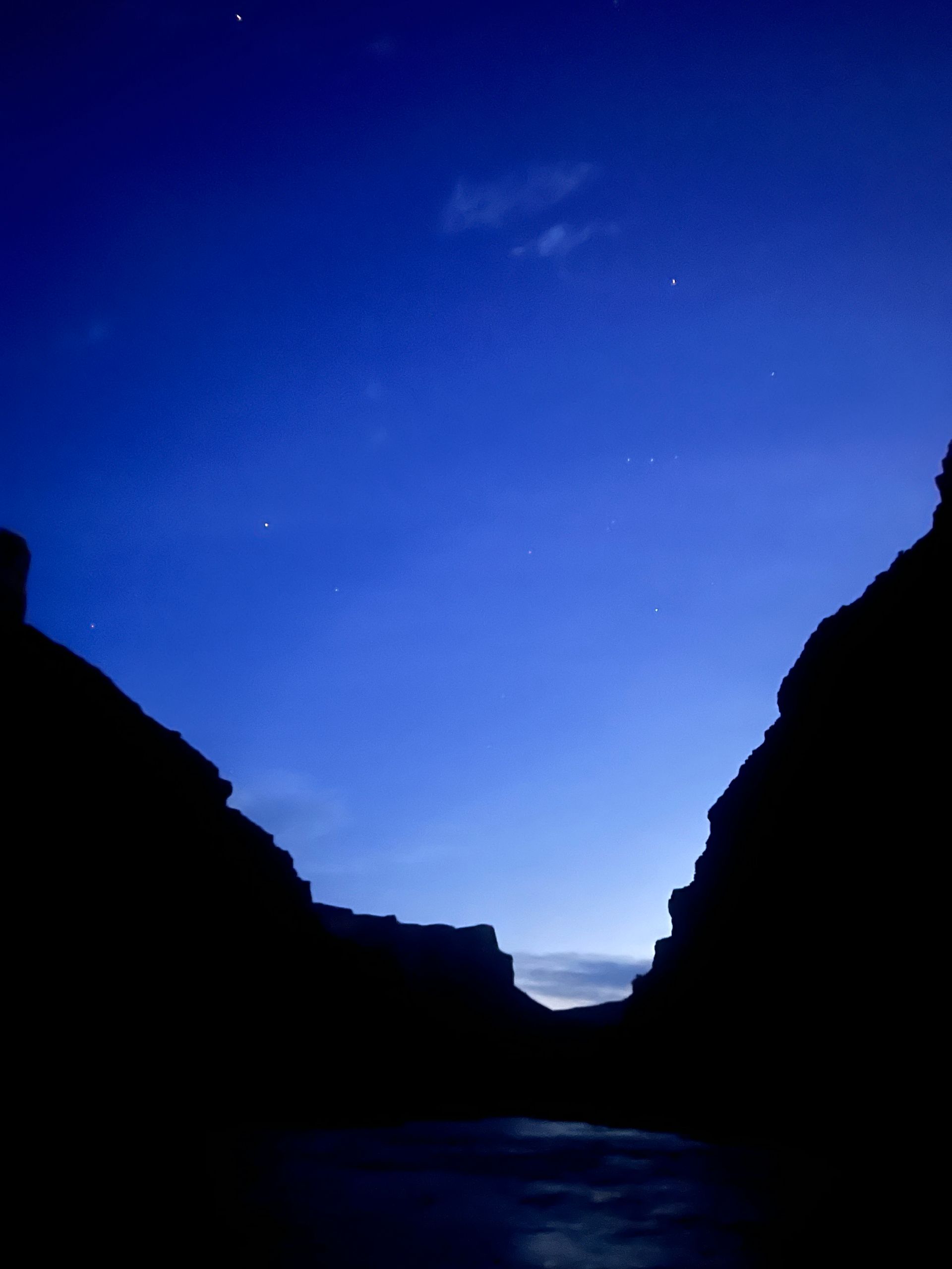
Night Sky on the Colorado River with the Milky Way and night sky cliffs.
By Walker Mackay • March 23, 2026
Half the Grand Canyon happens after sunset. See why the night sky—stars, silence, and space—defines the river trip experience.
Avon rafts camped at the confluence of the Tatshenshini and Alsek Rivers on a sunny warm day.
By Walker Mackay • March 19, 2026
Grand Canyon vs. Tatshenshini–Alsek: two legendary river journeys shaped by desert and ice. Discover how each delivers a completely different wilderness experience.
Rafting on a river with mountains and glacier in background. People paddle on a raft.
By Walker Mackay • March 10, 2026
The Tatshenshini River offers one of the last true wilderness rafting expeditions on Earth—glaciers, wildlife, and untouched landscapes in Alaska and Canada.
Sandy beach inside a cavern overlooks a river, with red rock canyon walls and a blue sky.
February 15, 2026
The Colorado River below Glen Canyon Dam flows through the lower reaches of Glen Canyon on its way to Lees Ferry , forming one of the most studied and discussed stretches of river in the American Southwest. Released from the base of the dam, the water is typically clear and tightly controlled. In recent years, however, lower water levels in Lake Powell have caused releases to come from shallower depths, warming the river compared to past decades and changing the conditions downstream. This reach is calm and approachable, making it a popular destination for kayaking, rafting, fishing, and flatwater exploration. Visitors often take time to linger along the banks, explore side canyons, and pull over at small beaches and alcoves—experiencing the river at an unhurried pace that encourages observation and learning.  Quick facts about this stretch of river naturally help frame why it matters: