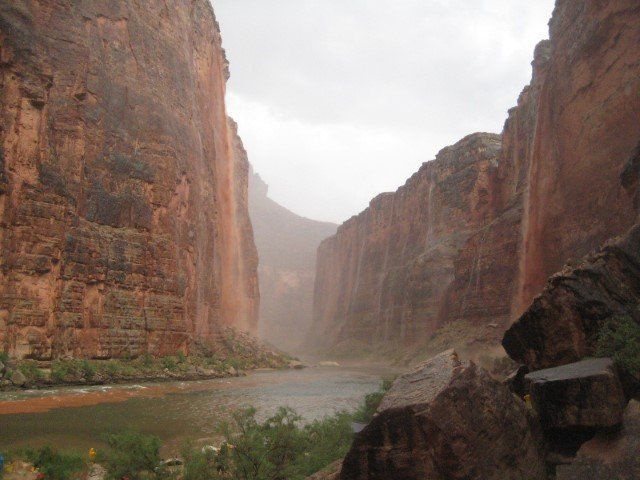
The desert air darkened with thick clouds that moments before could not be seen through the walls of a canyon a mile deep. The August heat suddenly gone, shifting as fast as the moods of the people as fast as blackened pillows blocking the sun. In what normally is a peaceful part of the canyon began to feel threatening. The monsoon that would open up would last about 35 minutes, thoroughly soaking through every piece of clothing- rain jacket or not- where five miles upstream and downstream was as dry as the desert ever was.
Two distinct images remain poignant to me. The first when the people huddling under the draping drenched rain fly peeled their dripping heads away from the canvas and saw the thousand foot waterfalls pouring red mud off the rim and realized this might not be so bad.
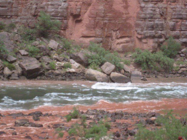
As they emerged from their wounded tent pile they saw the unnaturally green river swirl red like blood taken from hundreds of sources along the vein, the Colorado River.
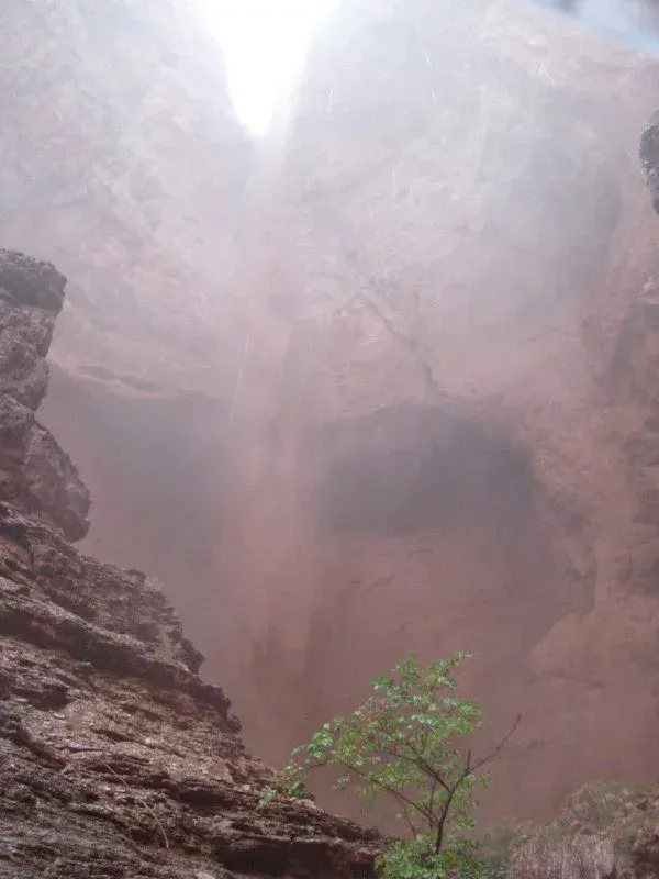
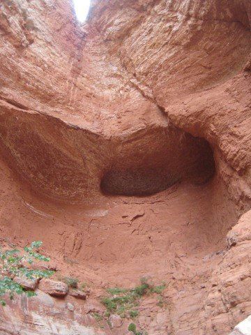
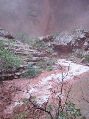
The second was when I walked away from the small beach camp called “Brower’s Bower”, named for David Brower who’s efforts in part prevented the Marble Canyon Dam that would have inundated this part of Grand Canyon, and walked into Red Bud Alcove. I had been here before when it looked like it usually does, an overhanging dry fall.
I crossed the stream and entered the short box canyon into a froth of thick moisture. The falls fell furiously, in some sort of hurry, and upon hitting the streambed pushed and rolled boulders toward the main artery.
I could see that this was how rapids form. Inside the alcove the noise of the water intensified as the volume of water increased. Feeling the power of that place in that moment taught me the extremes of this canyon.
Where thirty minutes prior the 115-degree temperature was sucking moisture out of my skin, now the water pounding my body felt like the verge of implosion.
And then it stopped. The rain first, the Arizona monsoon clouds empty. Then the water running together collecting the red sand down the slopes above and over the rim to the river, it slowed and stopped. All that red mud, changing the river to blood, went downstream like it has for six million years. Downstream. Back to green, the color of the water of the bottom of the reservoir named Powell. Time to cook burgers beans and brats for the hungry wet people.